Rateen: Difference between revisions
(Created page with '{{Infobox UK place |official_name=Rateen |irish_name= |scots_name= |static_image= |static_image_caption= |map_type= Northern Ire…') |
No edit summary |
||
| Line 1: | Line 1: | ||
{{Infobox UK place | {{Infobox UK place | ||
|official_name=Rateen | |||
|irish_name= | |||
|scots_name= | |||
|static_image= | |||
|static_image_caption= | |||
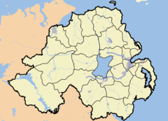
|map_type= Northern Ireland | |||
|latitude= 54.2220 | |||
|longitude= -7.321 | |||
|belfast_distance= 80 miles | |||
|population = | |||
|population_ref = | |||
|irish_grid_reference= H466315 | |||
|unitary_northern_ireland= [[Fermanagh District Council]] | |||
|country= Northern Ireland | |||
|post_town= ENNISKILLEN | |||
|postcode_area= BT | |||
|postcode_district= BT92 | |||
|dial_code= 028 677 51 | |||
|constituency_westminster= [[Fermanagh and South Tyrone (UK Parliament constituency)|Fermanagh and South Tyrone]] | |||
| population = | |constituency_ni_assembly= [[Fermanagh and South Tyrone (Assembly constituency)|Fermanagh and South Tyrone]] | ||
|lieutenancy_northern_ireland= [[County Fermanagh]] | |||
| population_ref = | |||
}} | }} | ||
[[Image:Handsketchrateen.jpg|thumb|left|Sketch of Rateen compared to neighbouring townlands]] | |||
Rateen is a townland in South-East [[County Fermanagh]], [[Northern Ireland]]. | Rateen is a townland in South-East [[County Fermanagh]], [[Northern Ireland]]. | ||
Revision as of 02:25, 27 September 2009
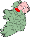
Rateen is a townland in South-East County Fermanagh, Northern Ireland.
Education
There used to be an old school in the townland of Rateen called Rateen National School. The ground was acquired in the late 1800's by the local authorities from Miss Lucy Mayne of Sedborough, Rateen, on a 50 year lease.
See also
| Stub icon | This article related to the geography of County Fermanagh, Northern Ireland is a stub. You can help Wikipedia by expanding it. |

